
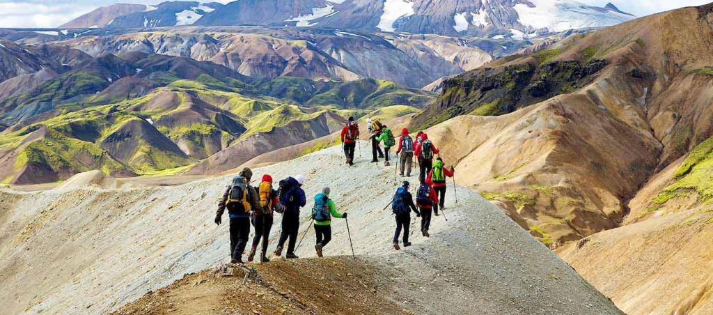
My Favorite Hiking Trails Around Reykjavík
Reykyavik is the capital of Iceland. The closest capital city to the polar region in the world is Reykyavik. It is an important fishing area and half of Iceland’s population lives in this city. This city is located on the coast of Faxaflöî bay in southwest Iceland. The Reykjavik coastal area consists of peninsulas, bays, straits and islands. During the Ice Age (up to 10,000 years ago) a large glacier covered the entire city area. Other parts of the city were surrounded by sea water.

Reykjavik is the ideal destination for a lover of mountains, volcanoes and glaciers. You can climb waterfalls here, walk on black beaches and mossy lava fields. There is nothing more refreshing than breathing in Iceland’s clean mountain air and relaxing in one of Iceland’s many natural hot springs.
Then let’s give you information about favorite hiking trails of Reykjavik.
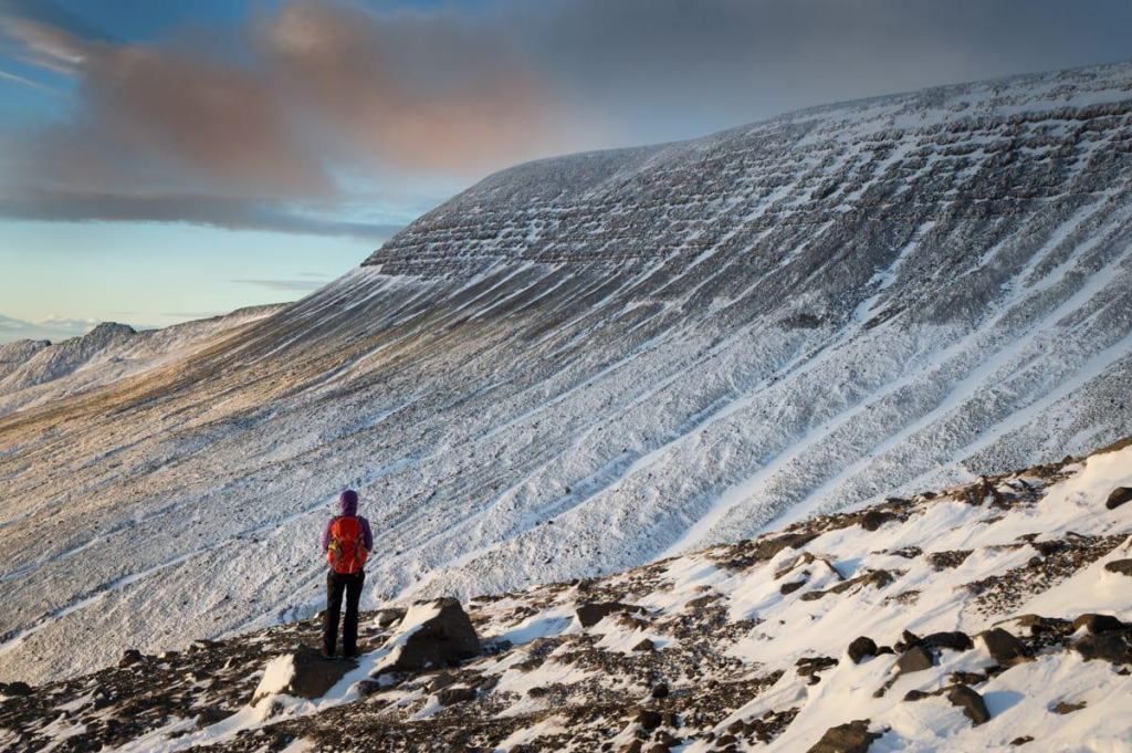
Móskarðshnjúkar

Móskarðshnjúkar is 20 minutes from Reykjavik and is also less explored by Icelandic natives. The summit belongs to Iceland’s most famous hiking mountain, Mount Esjan. This road leads to two bright cone-shaped hills on the east side. These hills appear sparkly from afar and have a distinctive bright yellow color as a result of rhyolites formed by volcanic rocks. This hike is very difficult, but the scenery is magnificent. You will pass through small lava fields covered with blue berries. The vegetation will gradually disappear as you go up the hills, but you will start to see basalt rocks and yellow rhyolite rocks above. Some areas are covered with snow all year round. The view from above is breathtaking, with panoramic views of Reykjavik as well as beautiful views of the neighboring peaks and ridges of the Escan Mountain Range.
- Hiking time: 4 hours
- Trail length: 3 km (6 km roundtrip)
- Elevation: 677 m
- Summit: 807 m
- Difficulty: Challenging
Top tip: Drive from Reykjavik to Mosfellsbær. Once you pass the town, turn right on the last turn towards Reykjadalur (first exit). After a 10-20 minute drive you will reach a sign listed as Hrafnhólar on the left (it can be easily missed). Follow the muddy road until you reach an old summer cottage. This is the end of the road and you should be close to a small bridge that you have to cross to start the walk. Note: This road may be closed to traffic during the winter months. It is necessary to walk.
Reykjadalur
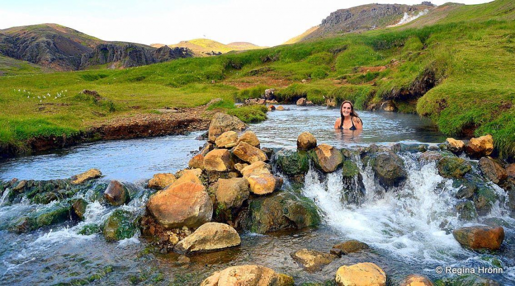
This walk will take you to a hot spring river which is homeless for bathing. Hveragerði or “Valley of Steam” is a town famous for its geothermal activity. Those who live here literally have hot springs in their backyard. There is also a geothermal park in town that is worth seeing. In the park, locals bake the famous black bread, using the geothermal ground as an oven. Wooden ramps and cabins were built around the hot springs to change clothes. Definitely worth experiencing this beautiful valley. You’ll see everything from live sulfur springs to small gurgling melting pots. It will take about 1 hour to reach the warm river where you can relax after the walk. (Don’t forget to bring a swimsuit!)
- Hiking time: 2 – 3 hours
- Trail Length: 3 km (6 km roundtrip)
- Elevation: 200-300 m
- Difficulty: Easy
Top tip: If you drive to Reykjavík, Reykjadalurla is 30-40 minutes away. Start in Reykjavik and travel along Hveragerði/Selfoss. Drive on the main road until you reach Hveragerði. You will reach a point where there is a right turn towards a golf course, but there you must follow the road to the left and continue until there is a car park next to a small river (Varmá).
Mt. Vífilsfell
One of the most popular hikes among Reykjavik citizens, this summit will offer one of the best views of Mount Esjan and the Reykjanes peninsula (the lower leg of “sheep-shaped” Iceland). Hiking can be inaccessible during the winter months, but in that case we recommend the nearby Bláfjöll (“Blue Mountains”), the most popular ski area around Reykjavík.
- Hiking time:1,5-2,5 hours
- Trail length: 3 km (6 – 7 km roundtrip)
- Summit: 655 m
- Elevation: 305 m
- Difficulty: Easy
Top tip: Only a 20 min drive from Reykjavík, head towards Hveragerði and Selfoss on the main road, route 1, until you reach a sign for Bláfjöll skiing area. Drive past it and take the next right turn and follow the road until you reach the roots of the mountain.
Mount Esja
Mount Esja (often referred to as “Esjan” or “Esja”) is probably the best known trail outside of Reykjavik. Be sure to meet many happy Icelanders to welcome you. Many Reykjavik residents have certainly climbed Mount Esja at some point in their lives, even though they have never climbed another mountain in Iceland. Many Icelanders go there every weekend and some almost every day. It is also popular with athletes. So don’t be surprised if you see people running past you, holding on and trying to breathe. Esja is a volcanic mountain range. This hiking trail will take you to the top of Þverfellshorn. At the very beginning you will cross a beautiful little river flowing down the mountain with pine trees and drinkable fresh water. As you climb higher, you will witness the magnificent view of both the city and its surroundings. Most hikers will only go as high as the big rock called “Steinn” or “The Stone”. From here, the road to the summit becomes steeper. When you reach the top, you really feel like you’ve accomplished something!
- Hiking time: 3-4 hours roundtrip
- Trail length: 3,5 km (7 km roundtrip)
- Summit: 780 m (Steinn: 760 m)
- Elevation: 780 m
- Difficulty: Challenging
Top tip: Heading east from Mosfellsbær, head straight for a few detours 20-30 minutes’ drive from Reykjavik. As you approach the mountain, you will encounter a large parking lot and a nice cafe at the foot of the track. This trail can also be reached by bus (from Hlemmur, take bus 15 and switch to 57 at Mosfellsbær).
Glymur Waterfall
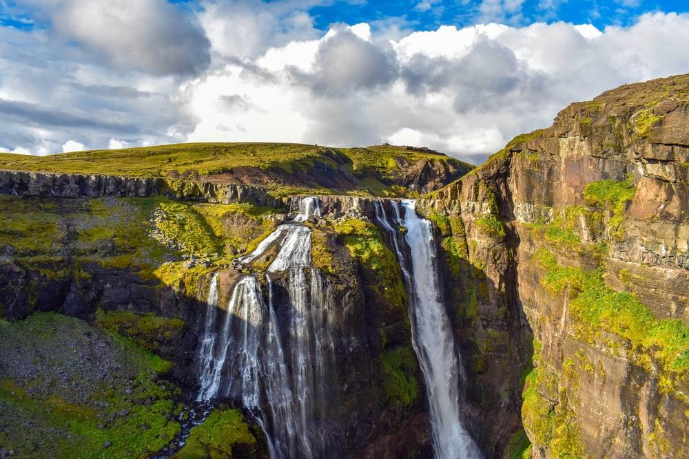
At 196 meters, Glymur is Iceland’s second highest waterfall and is located in Hvalfjörður, a deep fjord north of Reykjavik. Today Hvalfjörður is known as the “ghost” fjord. It gives most Icelanders 2 hours of bonus time by going through a tunnel under the sea. The “old” route is even more enjoyable these days. Because if you go this route, the roads are almost empty. You’ll cross steep mountain ranges, rivers and old farms on your right, and the calm sea on your left. At the end of the fjord, the Glymur waterfall will greet you. However, to reach the opposite side, you will have to cross the icy river that feeds the waterfall. The hike begins by passing through a small cave and crossing the Botnsá river over a wooden log. Caution: Some parts are strenuous and potentially dangerous and you will need to navigate the edges of steep descents. Hiking at the Glymur waterfall is incredibly beautiful. When viewed from below, you will catch the entire fjord view, along with the waterfall hidden behind the valley.
- Hiking time: 3 hours
- Trail length: 3 km (6 km roundtrip)
- Elevation: 280 m
- Difficulty: Easy – Challenging
Top tip: Glymur waterfall is located on the Hvalfjorður fjord in West Iceland, about an hour’s drive from Reykjavík. At the beginning of your hike you will pass some old farms and a few bridges. You will see an abandoned gas station, this time you can be sure to get close to the waterfall.

